DR Official Plan Map Overlays
Durham Region’s Official Plan can be accessed by clicking here.
The maps that support the official plan can be accessed through that document or by clicking here.
We have created these overlays to the best of our ability using the information that Plus Power has provided publicly. We cannot guarantee that they are free from minor errors. They are to be used for reference purposes only.
Map 2A Regional Natural Heritage System


Langmaid BESS Proposal Overlaid on Durham Regions Official Plan Map 2A
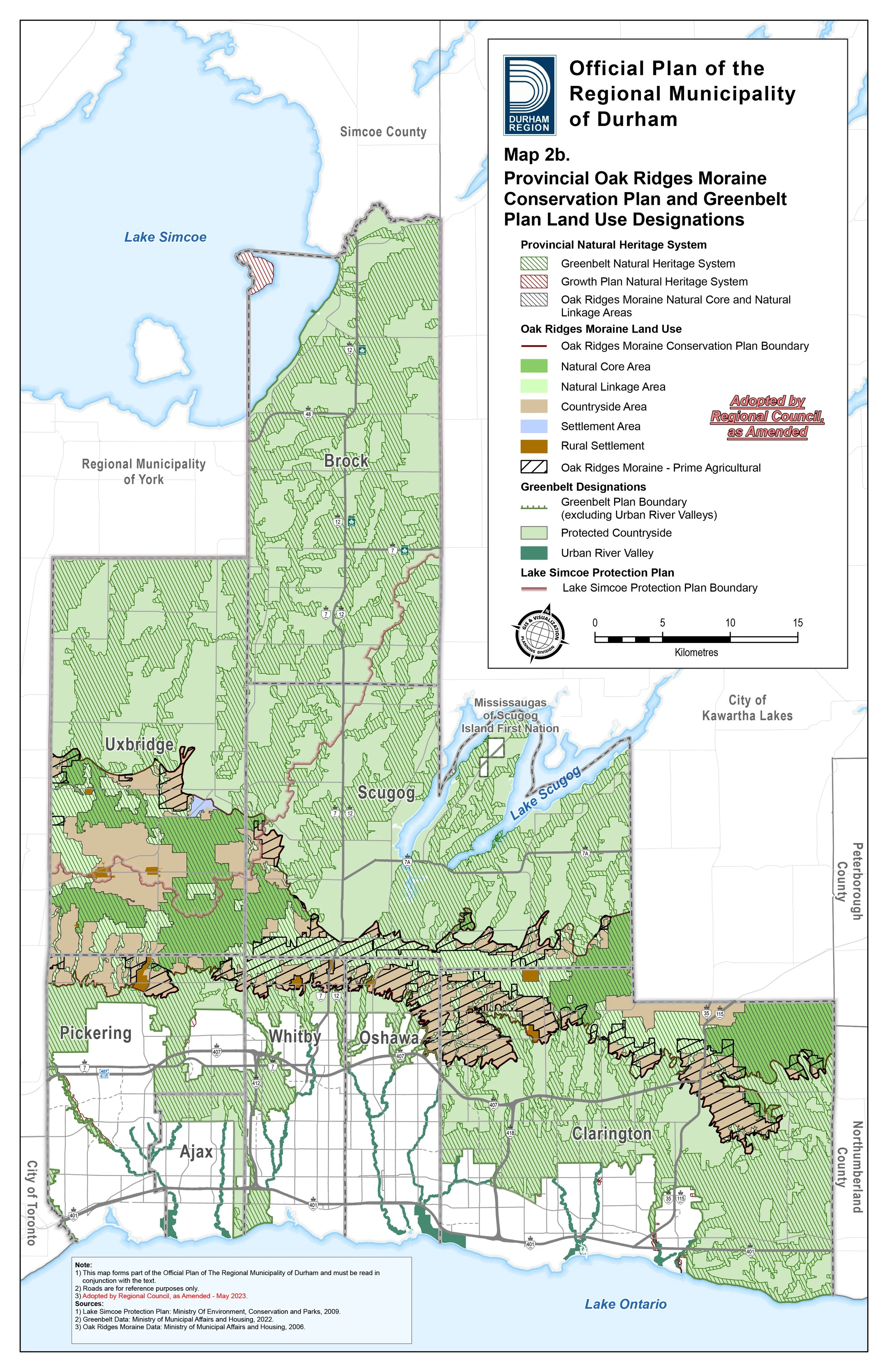
Map 2B Provincial Oak Ridges Moraine Conservation Plan and Greenbelt Plan Land Use Designations
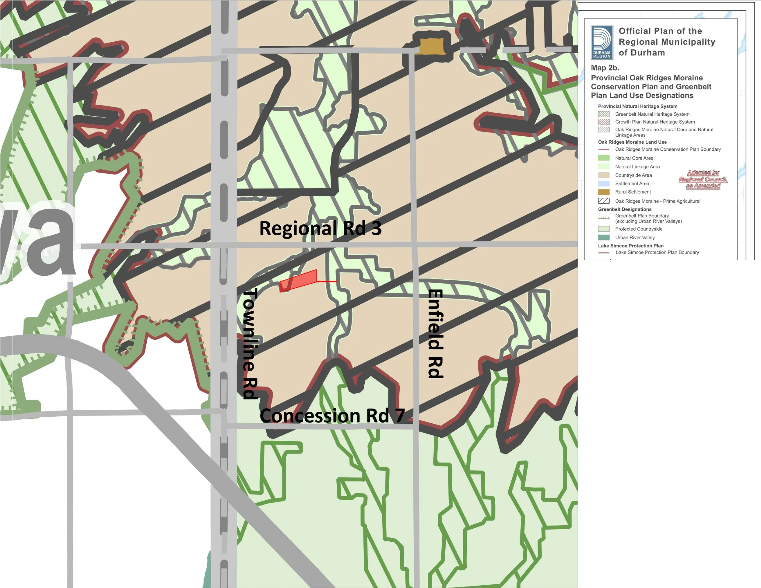
Langmaid BESS Proposal Overlaid on Durham Regions Official Plan Map 2B
Map 2C Water Resources System - Key Hydrologic Features


Langmaid BESS Proposal Overlaid on Durham Regions Official Plan Map 2C
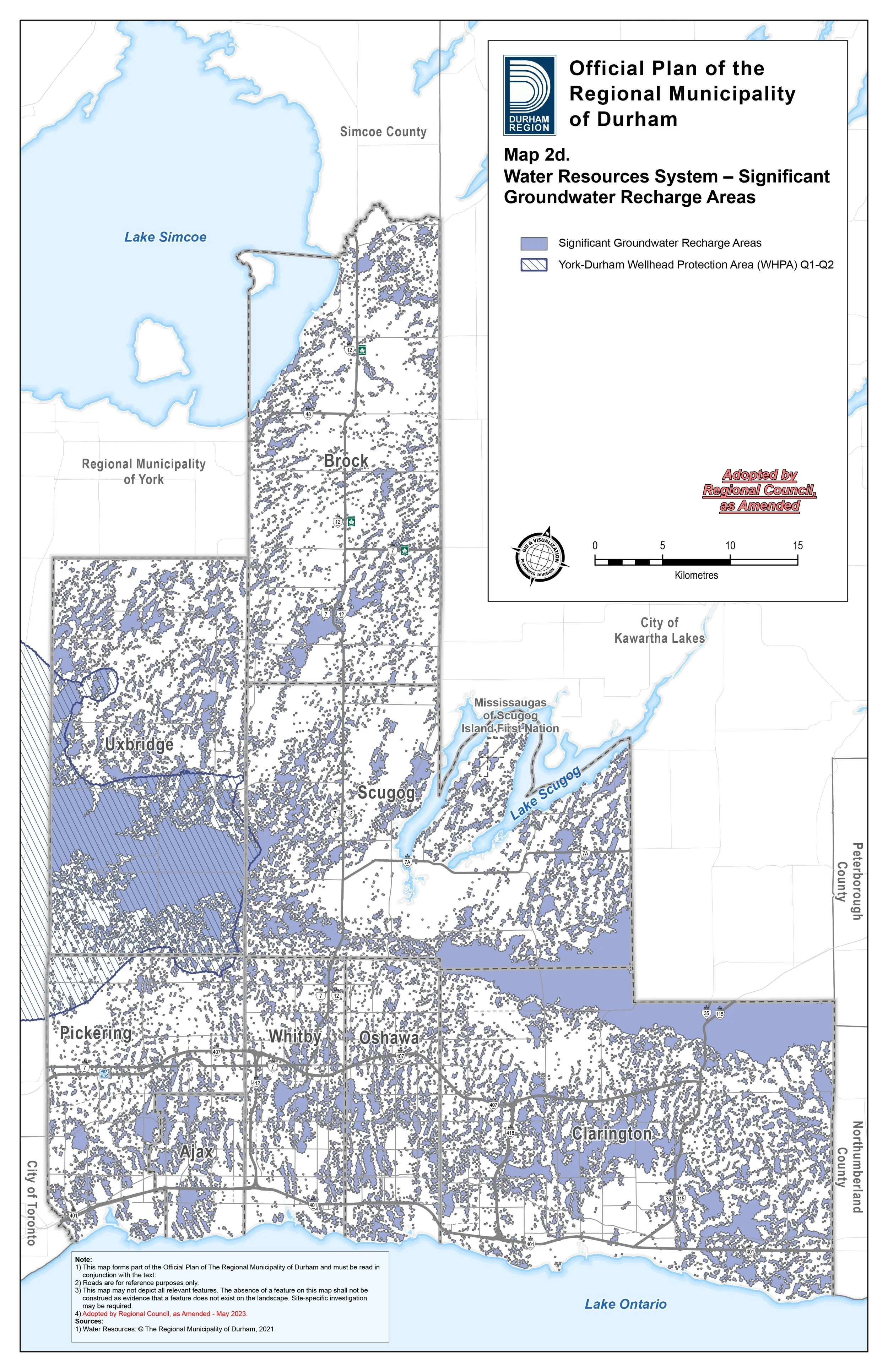
Map 2D Water Resources System - Significant Groundwater Recharge Areas
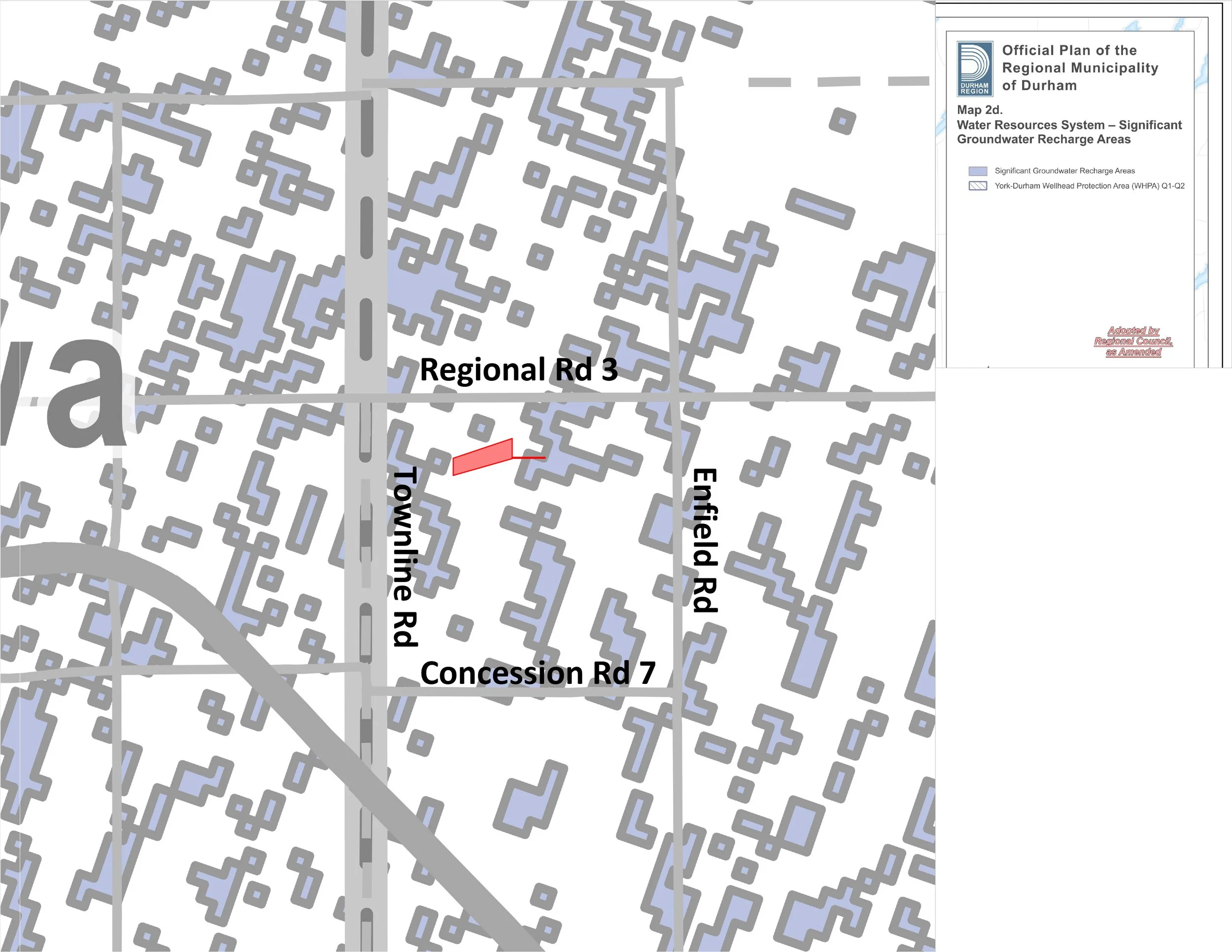
Langmaid BESS Proposal Overlaid on Durham Regions Official Plan Map 2D
Map 2E Water Resources System - Significant Surface Water Contribution Areas and Ecologically Significant Groundwater Recharge Areas
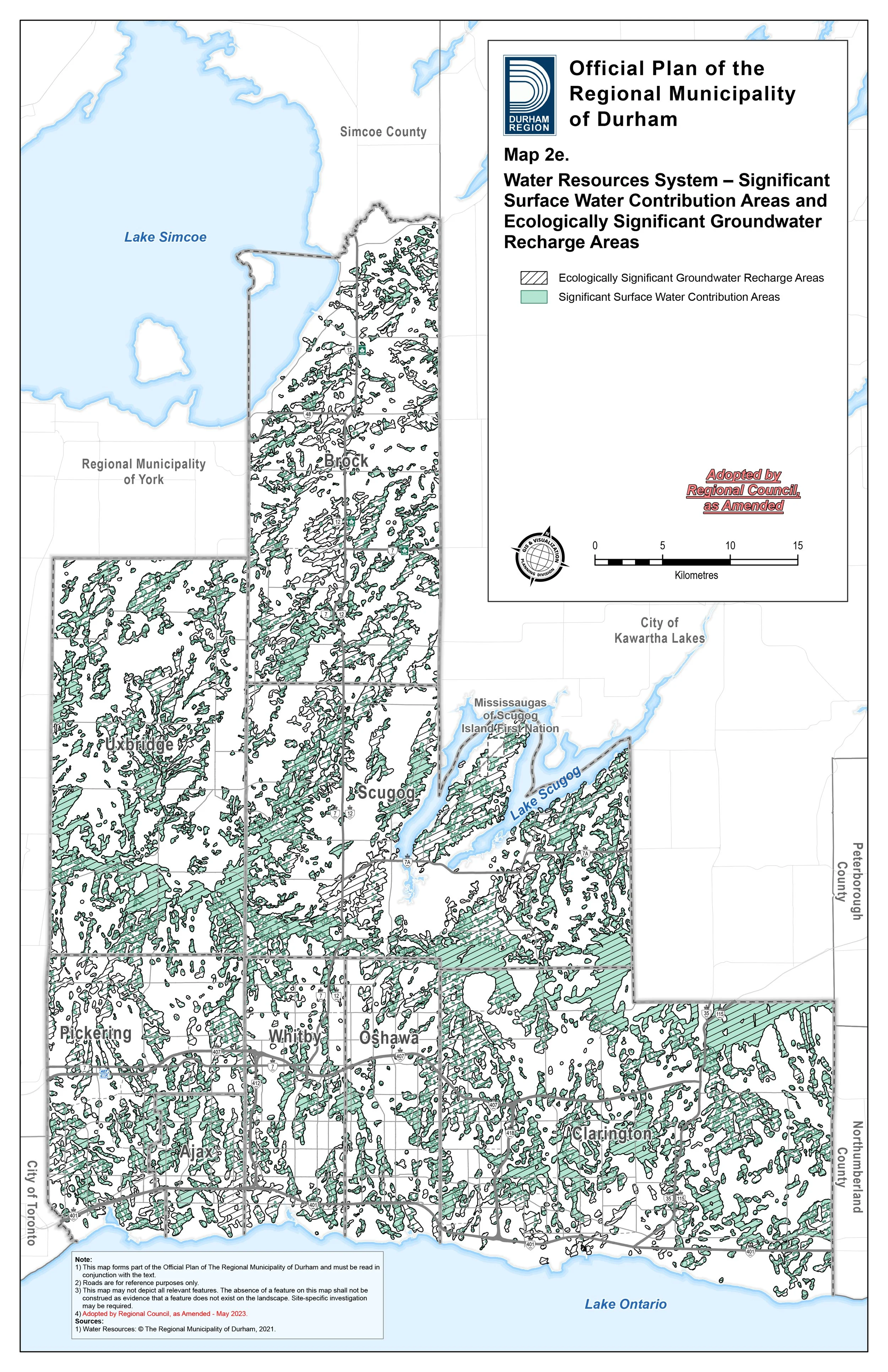

Langmaid BESS Proposal Overlaid on Durham Regions Official Plan Map 2E
Map 2F Source Water Protection
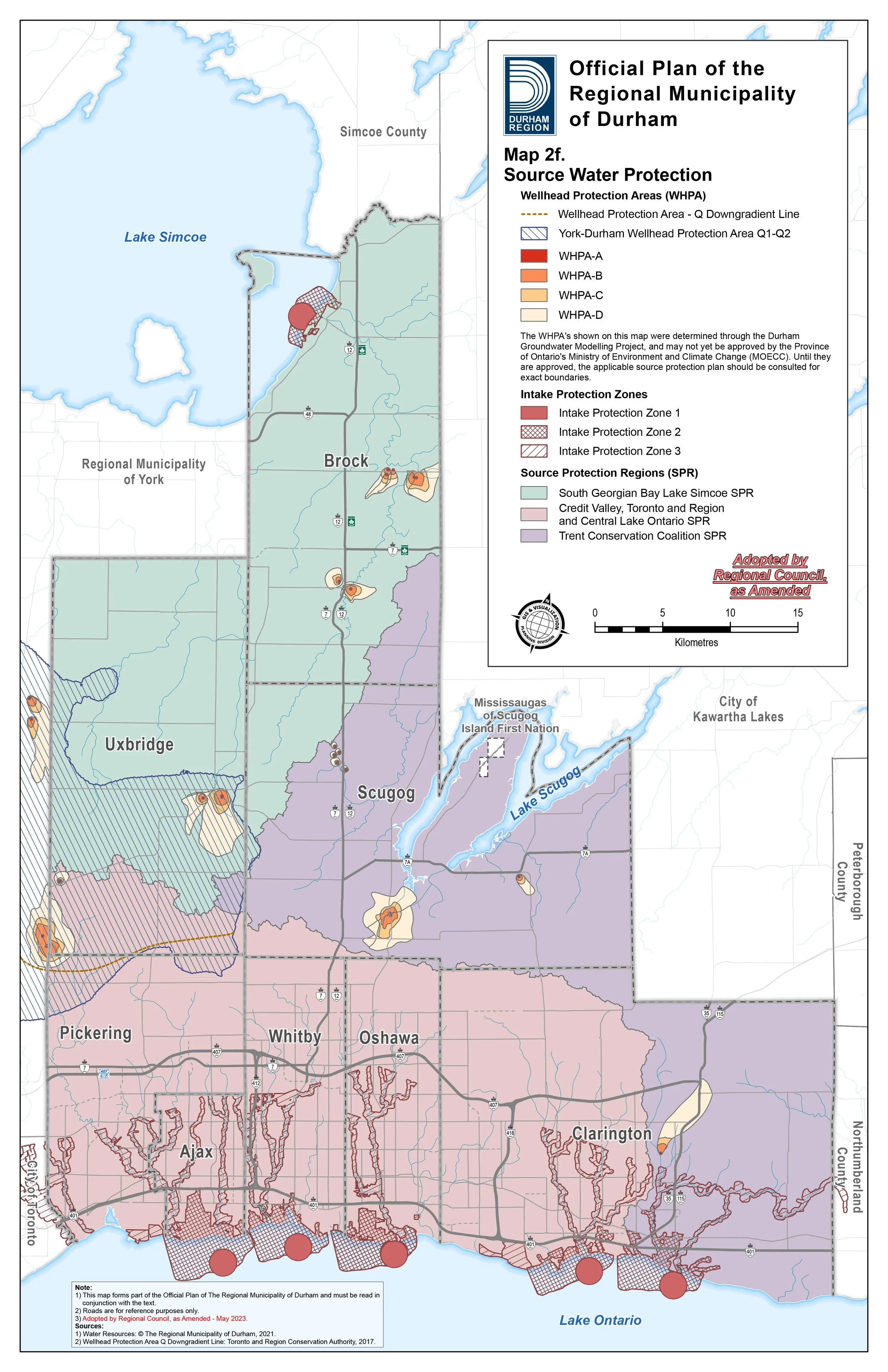

Langmaid BESS Proposal Overlaid on Durham Regions Official Plan Map 2F
Map 2G Highly Vulnerable Aquifers and Areas of High Aquifer Vulnerability

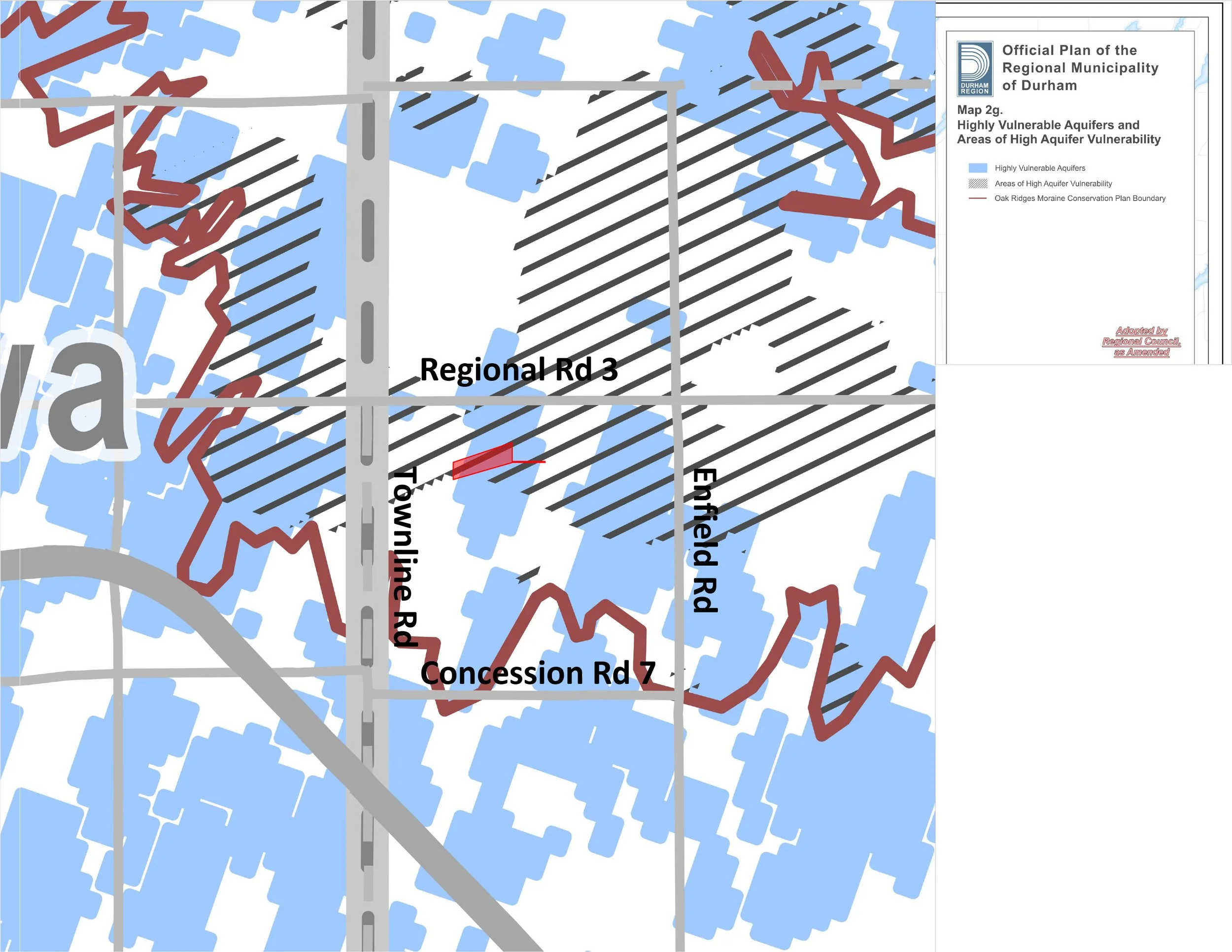
Langmaid BESS Proposal Overlaid on Durham Regions Official Plan Map 2G
Map 2H Landform Conservation Areas on the Oak Ridges Moraine
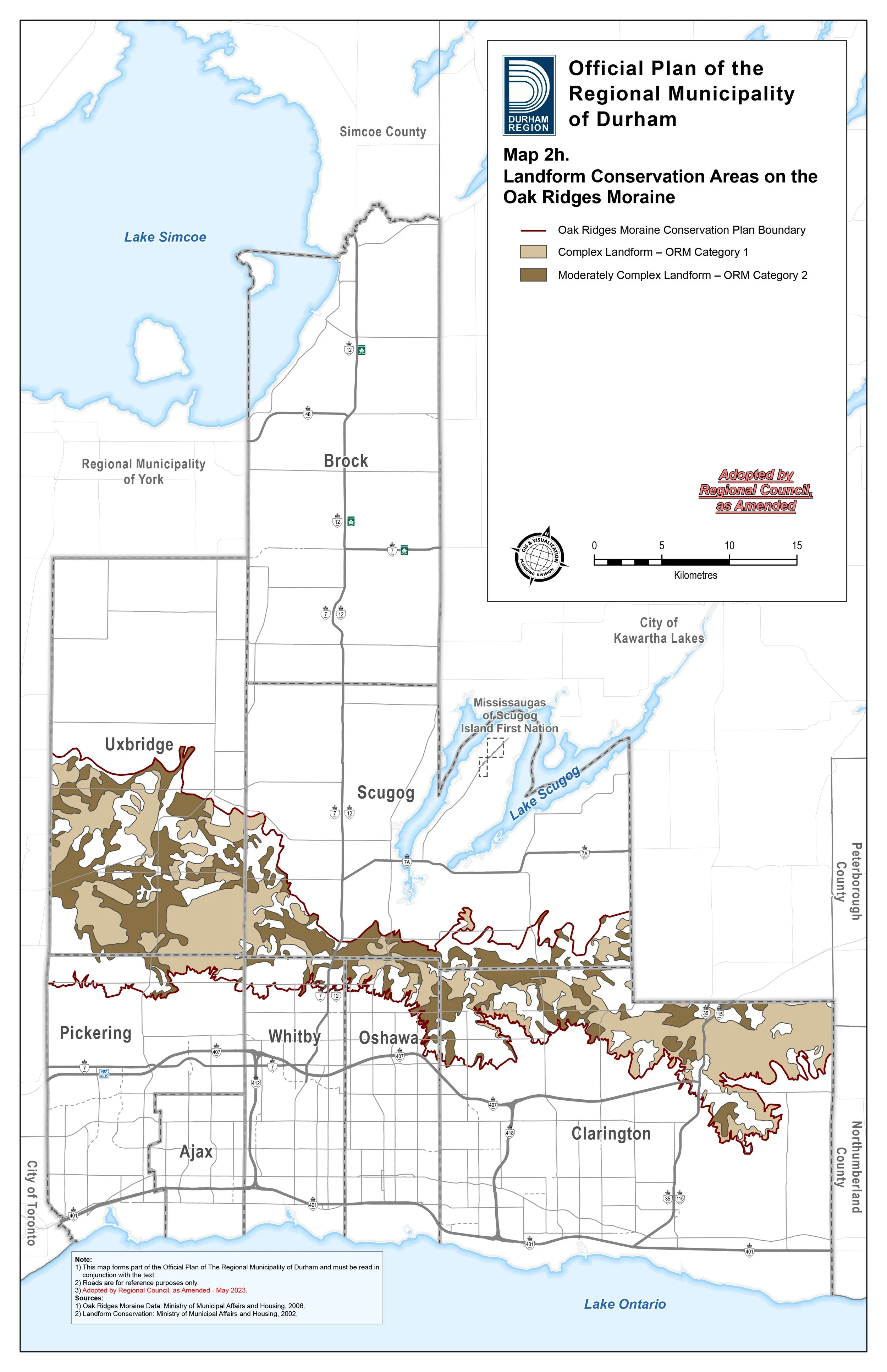
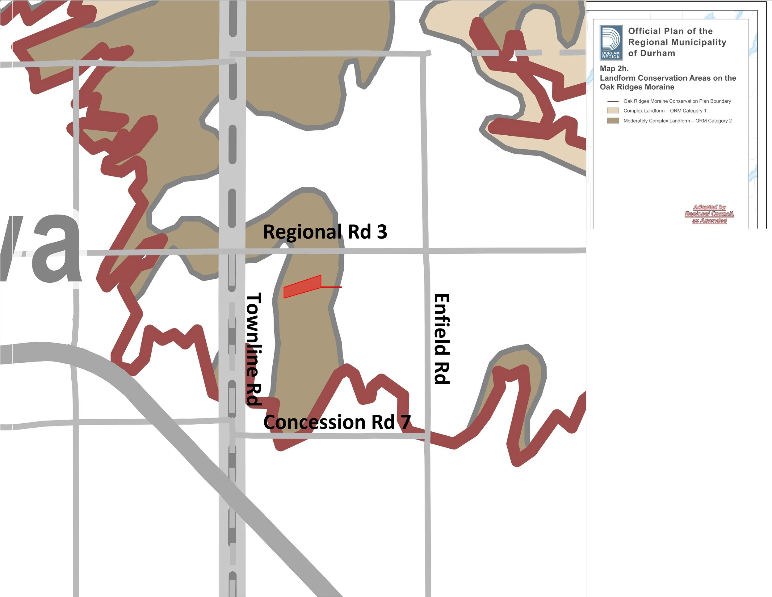
Langmaid BESS Proposal Overlaid on Durham Regions Official Plan Map 2H